The surface above the defect changes the whole job
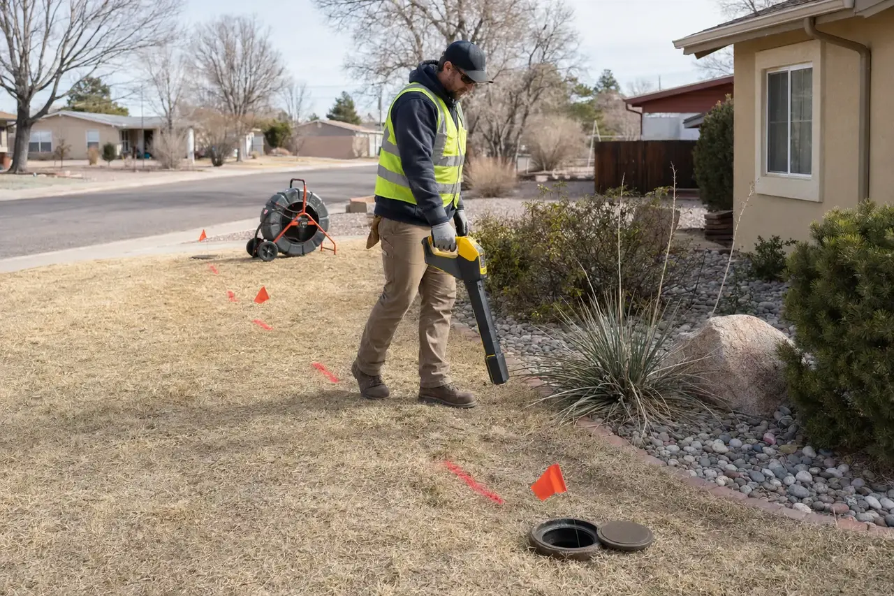
Without locating, a visible camera defect is only a distance measured from the access point. Surface marking helps determine whether it sits under soil, concrete, a structure, landscaping, or a right-of-way and informs the repair method and restoration scope.
A complete locate may be limited by camera access, blockage, collapse, signal interference, depth, or unusual line configurations. Locating a private sewer is also different from the public utility-marking service used before excavation.
- Plan a targeted spot repair
- Estimate excavation depth
- Find a missing cleanout
- Map a line before construction
Save more than a paint mark
Photograph or sketch the route, mark defect positions and estimated depth, note the access point used, and retain the camera counter distance. Permanent records are useful after landscaping changes or before future construction.
Before digging, required utility marking and permit procedures still apply. A sewer-camera locate does not replace locating gas, electric, water, communications, irrigation, or other buried facilities.
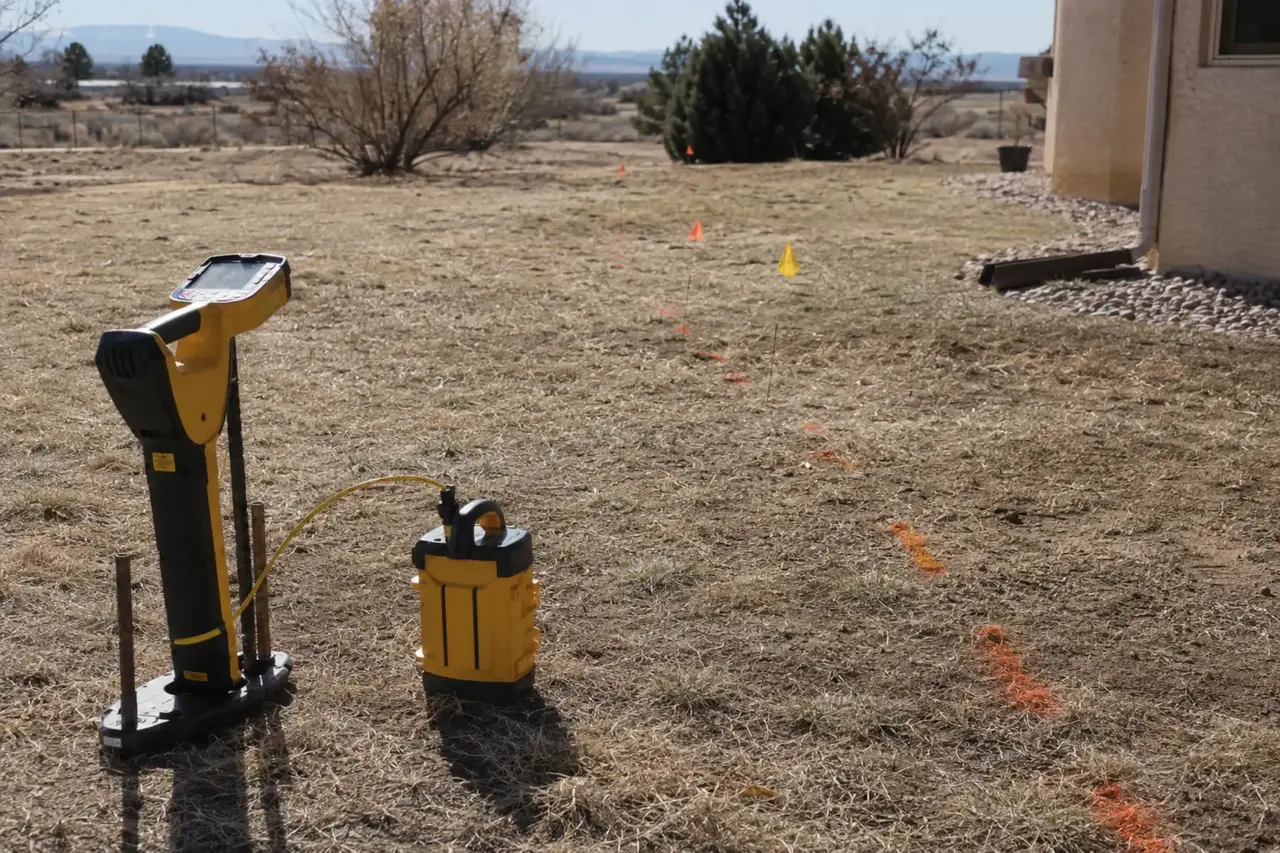
Locating supports access decisions, excavation limits, utility coordination, restoration planning, and more comparable repair estimates.
Locating with a camera transmitter or sonde
Many sewer cameras contain a small transmitter that emits a signal detected by a receiver at the surface. The operator moves the camera to a defect or known point, sweeps the surface for the strongest signal, and estimates depth. A separate sonde can sometimes be pushed or flushed when a camera is not the best tool.
Surface marks should identify the access point, route, important transitions, defect position, and estimated depth. Photographs and a sketch provide more lasting records than paint alone. Distance shown on the camera counter should also be retained because it helps reproduce the location later.
Accuracy limits and field conditions
Depth, soil, reinforced concrete, metal structures, utilities, fences, vehicles, and electrical interference can affect the signal. The route can also turn, cross other utilities, or pass beneath structures. Marks and depth should be treated as estimates until the pipe is safely exposed.
A complete collapse may prevent the camera or sonde from reaching the failure. Standing water and access limitations can also stop progress. In those cases, records, cleanout positions, plumbing layout, excavation, or other locating techniques may be needed to narrow the route.
A route and depth estimate make underground evidence useful for repair planning.
- 01Symptoms
Record which fixtures are affected, when the problem began, and whether it returns.
- 02Access
Identify a usable cleanout or another safe point for the required equipment.
- 03Evidence
Clean, inspect, and locate as needed to document the actual underground condition.
- 04Scope
Match the service method and restoration plan to what the evidence supports.
Private sewer locating versus utility marking
Locating a camera identifies the private sewer device being traced. It does not mark all underground utilities. Before excavation, required utility-notification and marking procedures must still be completed for gas, electric, water, communications, and other participating facilities.
Private facilities such as irrigation, lighting, propane, secondary electric lines, or unregistered utilities may require separate locating. The excavation plan should account for every known buried system. A sewer mark alone is not permission to dig or a complete excavation-safety plan.
How locating improves a repair quote
Location and depth determine access, equipment, excavation size, shoring considerations, restoration, and whether a trenchless approach offers value. A defect beneath open soil creates a different scope from one beneath concrete, a retaining wall, finished floor, or public right-of-way.
The proposal should reference the located position and state whether the quote assumes the mark and depth are accurate. Clarify how hidden utilities, deeper-than-expected pipe, or a defect extending beyond the mark will be handled. Good locating reduces uncertainty but cannot eliminate every concealed condition.
- Mark route and defect
- Record estimated depth
- Complete required utility marking
- Photograph permanent reference points
- Tie the quote to the located scope
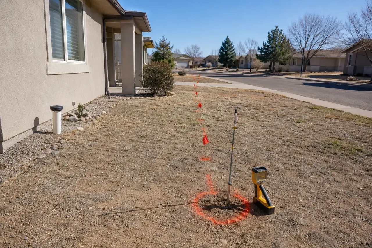
Good locating supports access decisions, utility coordination, excavation limits, restoration estimates, and more comparable bids.
Make the route useful years after the paint disappears
Paint and flags disappear. Convert the locate into a sketch showing the building exit, cleanouts, route turns, material transitions, repair marks, tap direction, and measurements from permanent corners or structures. Add approximate depth at important points and photographs that show the receiver marks in context.
If excavation confirms a different depth or route, update the record with measured information. Photograph the exposed line and nearby utilities before backfill. Record pipe material, diameter, and any connections. A verified as-built map becomes more valuable than the original electronic estimate.
Keep the map available before future cleaning or construction. It can reduce setup time, protect repaired sections, and help evaluate additions, landscaping, fences, pools, or driveway work. Keep in mind that old records may not show later repairs or reroutes, so field verification remains important.
- Measure from permanent features
- Update marks after exposure
- Record material and cleanouts
- Keep the map with property documents
Know the sewer route before changing the yard
Knowing the private sewer route is useful before installing fences, trees, retaining walls, pools, additions, sheds, driveways, or irrigation. Construction over the lateral can restrict future access, add loads, or damage the pipe. Add the verified route to project plans early enough to adjust the layout.
A historic sketch should not substitute for current field confirmation near planned excavation. Previous repairs may have rerouted the line, and surface landmarks may have changed. Use locating together with required utility marking and safe excavation practice. When the line is exposed, update the map with measured information rather than preserving an inaccurate estimate.
Material, cracks, joints, offsets, corrosion, roots, and surrounding usable pipe.
Depth, route, utilities, structures, pavement, landscaping, and equipment space.
Testing, backfill, cleanup, restoration, records, exclusions, and warranty.